
Projects and Case Studies
Custom Software Development in Production
Frog Ferry Mobile Schedule and Ticketing


Modern Transit, Built for Your Community
Frog Ferry is a planned passenger ferry service connecting Portland, Oregon neighborhoods along the Willamette River. To support their launch, Building A New Box designed and built a full-featured mobile transit app from the ground up — a complete platform that any regional transit agency can adopt to modernize their rider experience.
This isn't a prototype or a proof-of-concept. It's a production-ready system that handles everything riders and operators need: booking tickets, tracking vehicles in real time, managing trips, and boarding passengers securely via digital QR codes — all from a modern iOS and Android app.
iOS & Android
One app, both platforms. Riders get a consistent, modern experience whether they're on iPhone or Android.
Security First
Built using industry-standard practices such as encryption at rest, encrypted QR codes and Role Based Access Control so passengers only see their own data.
Multi-language
Designed from the beginning to support multiple languages throughout the app.
What Riders Get
Passengers deserve a transit experience that feels as easy as booking a rideshare. This app delivers exactly that — a clean, intuitive interface that guides riders from route selection all the way to boarding without friction.
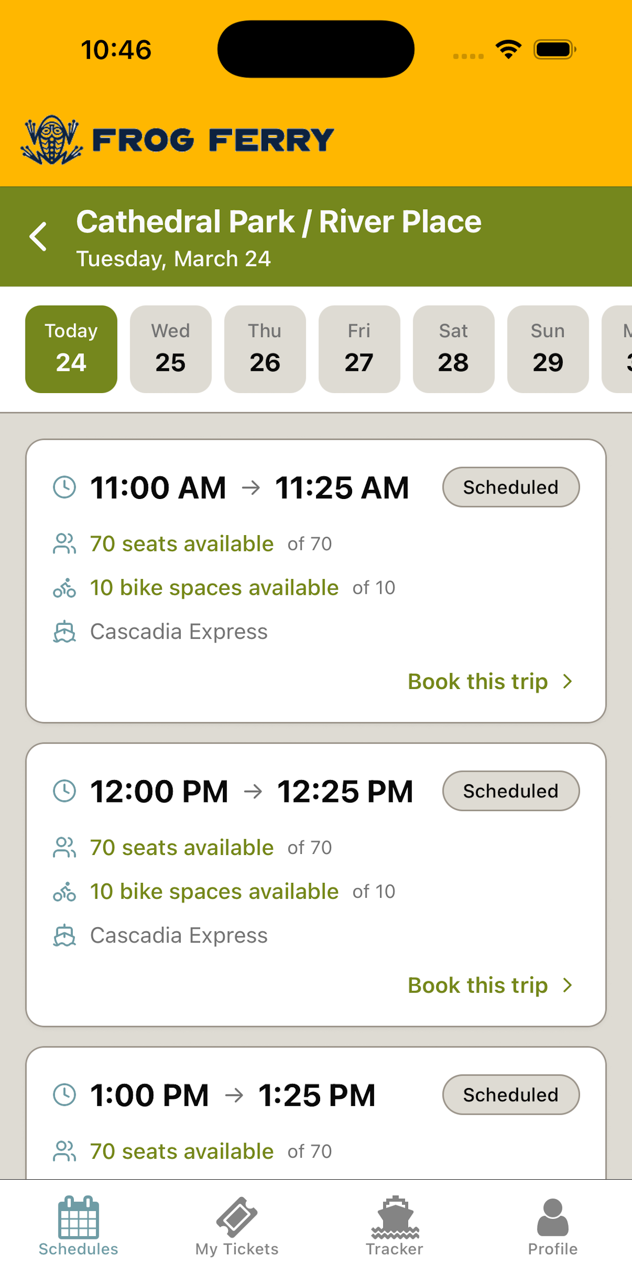
Browse & Book
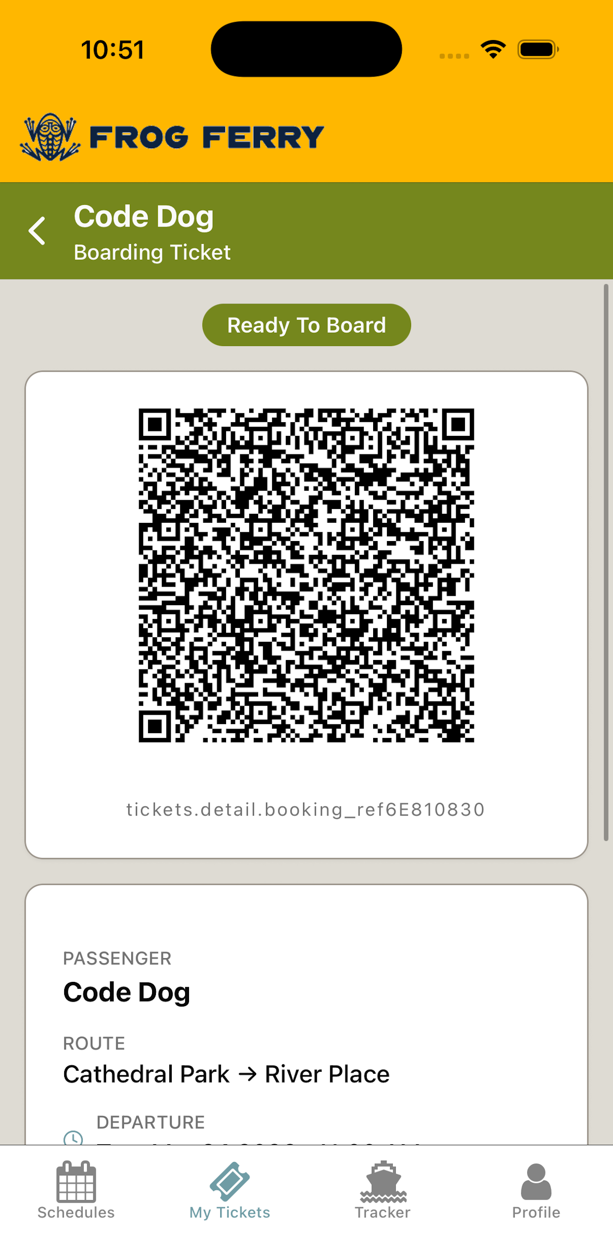
Digital Boarding Pass
Live Tracking
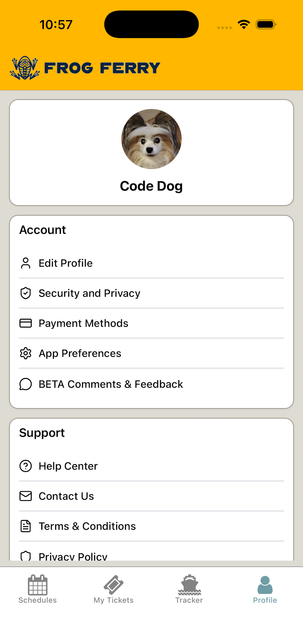
Rider Profile
Core Features
The platform was built around the complete rider journey — from discovering a route to stepping off at their destination. Every feature below is included in the implementation and ready to be configured for your agency's routes, branding, and fare structure.
🗓️ Route Search & Booking
Riders browse available routes, select departure times, choose the number of passengers, and pay — all in a few taps. Seat availability updates in real time so no one gets surprised at the dock.
💳 Secure In-App Payments
Integrated with Stripe, the app accepts credit cards, Apple Pay, and Google Pay. Refunds and cancellations are handled automatically — no manual processing required.
📍 Real-Time Tracking
Riders can watch their vehicle approach on an interactive map, updated live. Location, next stop, and capacity are all visible at a glance — reducing boarding congestion and rider anxiety.
🎟️ Digital QR Boarding Passes
Tickets live in the app as encrypted QR codes. Boarding agents scan them with a companion Operator App. No paper, no queues, no manual manifest checks.
🔔 Push Notifications
Riders receive automated alerts for booking confirmations, departure reminders, delays, and when their vessel arrives. Keep passengers informed without a single staff phone call.
🧑✈️ Operator Check-In App
A separate companion app for boarding agents lets staff scan tickets, view the passenger manifest, and manage trip capacity — all from a phone or tablet, no dedicated hardware needed.
Built for Operators, Not Just Riders
Most transit apps are built from the rider's perspective. This platform treats your operations team as a first-class user. The system was designed with transit operators in mind — because a great passenger experience starts with giving staff the right tools.
Fraud-Proof Ticketing
Tickets are encrypted and one-time use only. The system detects and blocks screenshot reuse, expired passes, and scans from outside the terminal area — automatically.
Overbooking Prevention
Seat capacity is enforced at the database level. Even if dozens of riders try to book the last seat simultaneously, the system guarantees only one booking goes through.
Location Integrity
GPS position updates are validated server-side. If a reported location is physically impossible given the vessel's speed and last known position, it's automatically rejected and flagged.
What's Included in Delivery
This isn't a SaaS subscription with a vendor holding your data. You receive a fully owned, configurable platform built on open, industry-standard technology — with no proprietary lock-in.
Branded iOS & Android apps
Configured with your agency's name, logo, colors, routes, and fare structure.
Operator companion app
Boarding agent tools for ticket scanning, manifest review, and trip management.
Payment processing setup
Stripe integration configured to your agency's bank account. Standard Stripe transaction fees apply.
App Store submission
Handled end-to-end. Your apps go live in the Apple App Store and Google Play under your agency's account.
Route & schedule configuration
All terminals, routes, vessel profiles, fare classes, and departure schedules set up for your network.
Documentation & handoff
Full technical documentation so your team feels comfortable using the platform.
What's Coming Next
The platform roadmap includes features that further reduce operational overhead and improve the rider experience. These are planned for future releases and available for custom development engagements.

First deployed with Frog Ferry
This platform was originally designed and built for Frog Ferry, a passenger ferry startup launching on the Willamette River in Portland, Oregon. Everything you see here — the booking flow, the live tracking, the operator tools — was built to real-world transit requirements, not a demo environment. The white-label version is the same proven codebase, adapted for your routes and branding.
Ready to Modernize Your Rider Experience?
Whether you're exploring a pilot program or planning a full network rollout, I'd be glad to walk you through the platform and discuss what a deployment would look like for your agency.
Get in Touch